Nebraska's Surface Transportation Program for 2027

Message from Director Vicki Kramer
The mission of the Nebraska Department of Transportation (NDOT) is to provide the best possible transportation system for the movement of people and goods. The Fiscal Year (FY) 2026 Nebraska Surface Transportation Program specifies how the Department plans to preserve and modernize existing assets, increase safety of the transportation system and expand capacity of the network.
The book contains:
-
Contact information for the NDOT District Engineers and Highway Commissioners
-
District Specific Project Maps
-
The FY 2027 Construction Program
-
The Five-Year Planning Program
-
Summary of program changes since last published
The Fiscal Year (FY) 2027 Nebraska Surface Transportation Program outlines the Nebraska Department of Transportation’s (NDOT) approach to preserving the state’s highway and bridge system, improving safety, and making targeted investments to support mobility and economic activity. The program book includes the FY 2027 Construction Program, Five-Year Planning Program, District project maps, and a summary of changes since the previous publication.
The state highway system is the backbone of Nebraska’s transportation network, carrying nearly 65 percent of all traffic and connecting communities to key economic centers. The system supports approximately $5.3 billion in annual economic activity and more than 500,000 jobs. Demand on the system continues to grow, with freight value and tonnage projected to nearly double over the next 25 years.
NDOT annually evaluates system conditions and uses forecasting tools to identify when and where improvements are needed. While 97 percent of state-owned bridges and 96 percent of highways are currently in good or fair condition, maintaining these outcomes is becoming more difficult. At current funding levels and considering NDOT’s purchasing power, 30 to 35 percent of highways are projected to fall below good condition by 2032. The department continues to balance preservation, modernization, and capacity needs, recognizing that tradeoffs will be required to sustain system performance.
The Legislature’s Infrastructure Review Task Force (IRTF), established through LB 558 (2025), is evaluating these trends and the long-term needs across our 3,500 bridges and 10,000 miles of state highways. NDOT continues to work with the IRTF on assessing the economic impact of transportation investment and reviewing how other states have diversified funding sources.
Efficiency within project delivery remains a core focus. In February 2026, NDOT assumed full responsibility for environmental review under the National Environmental Policy Act (NEPA), becoming the ninth state to do so. This builds on the department’s partial assignment authority established in 2018 and allows for more efficient coordination and decision-making. NDOT continues to pursue additional federal delegations, including authority related to interstate access, stormwater permitting, and threatened and endangered species consultation. At the state level, LB 36 (2025) expanded tools for mitigation through in-lieu fee programs.
NDOT is also advancing innovation in project delivery. Digital Project Delivery (DPD) integrates data and 2D/3D modeling to improve coordination, transparency, and long-term asset management. The department anticipates delivering its first DPD projects in FY 2027 and will continue modernizing its systems to support more efficient delivery and lifecycle management.
NDOT remains committed to maintaining a safe, efficient, and reliable transportation system. Continued coordination with policymakers and stakeholders will be essential to address long‑term funding challenges and ensure the system can meet future demand.
Download the 2027-2032 Surface Transportation Program Book
(Some pages are intentionally blank for printing purposes)
*Project cost estimates contained in the book represent the planning estimates of the total costs of a project. These include: preliminary engineering, right-of-way, utilities, early planning estimates of construction, and other costs. They do not represent the final estimated construction cost of any project which goes to letting for bid by contractors.
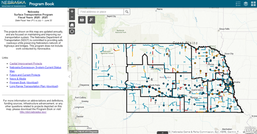
Interactive GIS Map
Click on the image to visit the GIS map webpage.